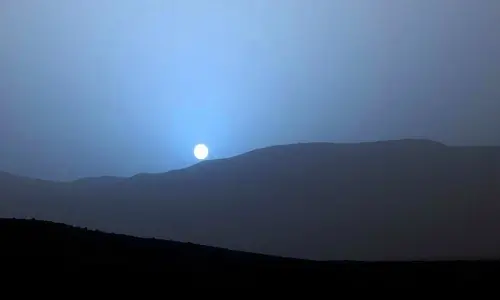
We Are Living in a Moment That No Human Before Us Has Ever Witnessed—An Actual Photograph of a Sunset on Mars
Facts 12/05/2025 21:27
Mount Rainier, standing majestically at 14,411 feet in Washington State, is not only a symbol of natural beauty but also a potentially devastating geological hazard. Crowned with over two dozen glaciers, it is the most heavily glaciated peak in the contiguous United States. While its icy summit and scenic slopes draw thousands of hikers and tourists each year, scientists and emergency planners have long warned of a hidden threat: lahars. These destructive volcanic mudflows, triggered by melting ice and volcanic activity, could race down the mountain’s river valleys at terrifying speeds—placing over a million people in surrounding communities in grave danger.
Lahars are not new to Mount Rainier’s geological history. Thousands of years ago, massive lahars created deep valleys and reshaped the surrounding lowlands. The most notable, the Osceola Lahar, occurred approximately 5,600 years ago and traveled over 50 miles, reaching as far as present-day Puget Sound. Such events have carved a legacy of destruction, but today the risk is magnified by urban development. Cities like Orting, Puyallup, and Sumner sit directly on ancient lahar deposits and lie squarely in the path of any future flows.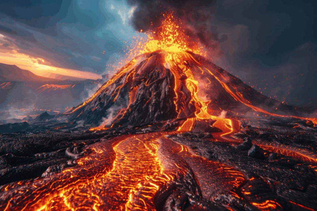
The key danger posed by Mount Rainier stems from its glaciers. Unlike some volcanoes where lava is the main concern, Mount Rainier’s ice can melt rapidly during an eruption or even from non-eruptive events like landslides or seismic activity. When the ice melts, it mixes with ash, rock, and debris to form fast-moving lahars that can travel at speeds of up to 60 miles per hour. These flows are capable of obliterating roads, bridges, and entire communities in minutes. Their unpredictability and sudden onset mean that authorities must remain constantly prepared.
Recognizing this threat, local and federal agencies have ramped up preparedness efforts. The U.S. Geological Survey (USGS) has installed monitoring equipment around Mount Rainier to detect seismic activity, ground deformation, and temperature changes. The Mount Rainier Volcano Observatory works closely with emergency management teams to ensure that warning systems are in place. In particular, the lahar warning system in the Puyallup River valley is one of the most advanced in the nation, designed to alert residents with enough time to evacuate safely.
Schools in high-risk zones conduct regular evacuation drills, and city planners have developed detailed lahar evacuation routes. Some towns even have “volcano evacuation maps” posted in public areas, and many local residents carry emergency kits in their vehicles. However, experts caution that public awareness and readiness still vary widely. Because Mount Rainier has not erupted in modern memory, some residents underestimate the threat or remain unaware of the mountain’s potential for disaster.
Climate change may further complicate the risk. As global temperatures rise, the glaciers on Mount Rainier may become more unstable. Increased rainfall, melting ice, and shifting weather patterns could all contribute to a higher chance of landslides or meltwater-triggered lahars, even without a volcanic eruption. Authorities are increasingly factoring in climate models as they update hazard maps and emergency plans.
In conclusion, Mount Rainier’s snow-covered peak is both a stunning natural wonder and a looming threat. The millions living in its shadow must balance admiration with caution. Scientists cannot predict exactly when the next lahar will occur, but history, science, and modern monitoring all point to the same truth: it is not a question of if, but when. Continued investment in public education, emergency infrastructure, and scientific research is essential to safeguarding lives when nature inevitably asserts its power once again.