More areas under cyclone signals as 'Pepito' intensifies anew
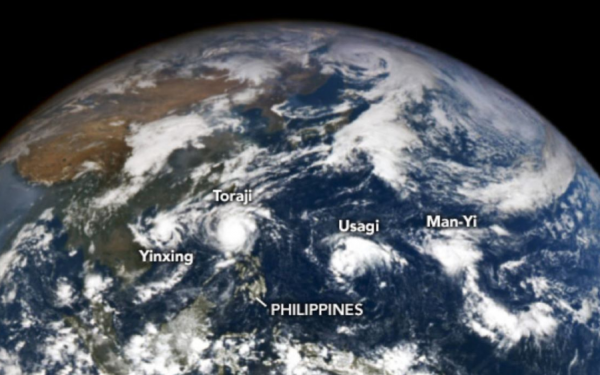
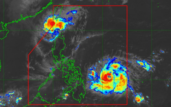
 RAMMB/Himawari-9 satellite imagery
The state weather bureau has raised tropical cyclone wind signals over more areas as typhoon Pepito (international name: Man-yi) intensified anew Friday afternoon.
In its 5 p.m. weather bulletin, PAGASA said the center of Pepito was last located 465 kilometers east of Guiuan, Eastern Samar, packing maximum sustained winds of up to 150 kilometers per hour near the center, with gusts of up to 185 kph. It is also moving west-northwest at 30 kph.
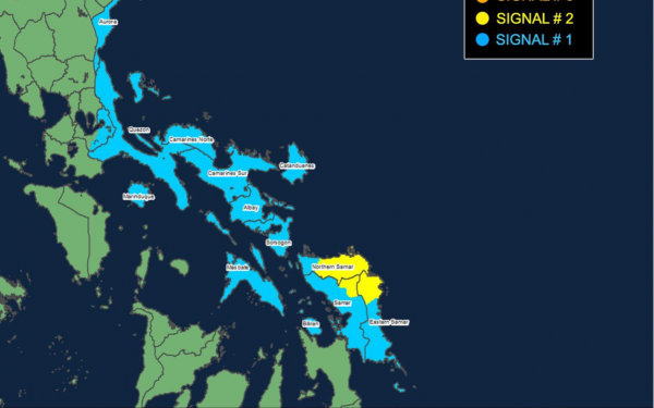
Signal No. 2, where gale-force winds pose minor to moderate threat to life and property, is currently raised over the eastern portion of Northern Samar, the northern portion of Eastern Samar, and the northeastern portion of Samar.
Signal No. 1 is likewise raised over Aurora, Quezon, the eastern portion of Laguna, Marinduque, Camarines Norte, Camarines Sur, Catanduanes, Albay, Sorsogon, and Masbate.
Moderate to heavy rains may persist over Northern Samar, Eastern Samar and Sorsogon until Saturday afternoon.
PAGASA also said there is a moderate to high risk of life-threatening storm surge with peak heights reaching 3.0 m above mean sea level in the next 48 hours over the low-lying or exposed coastal localities of Aurora, Quezon, southeastern Batangas, northwestern Romblon, Marinduque, Bicol Region, Northern Samar, Eastern Samar, Samar, and Biliran.
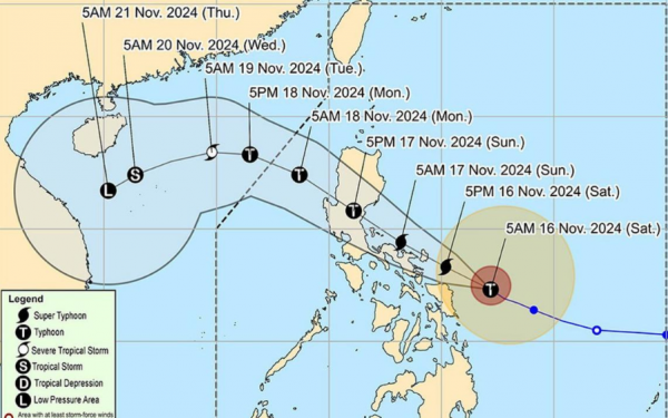
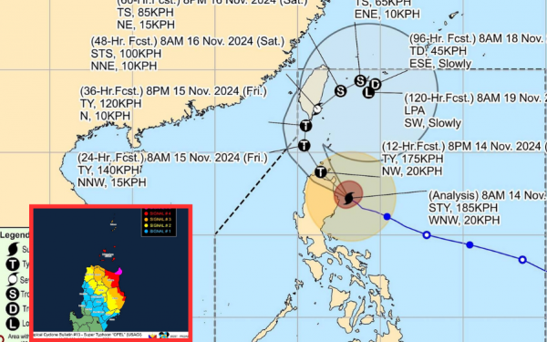
 PAGASA forecast track of Typhoon Pepito
Pepito is “more likely” to make landfall in the vicinity of Catanduanes between Saturday night to early Sunday morning.
PAGASA, however, said a landfall scenario over the eastern coast of Camarines Sur, Albay or Sorsogon during the same time frame, over the eastern coast of Northern Samar between Saturday afternoon to evening, or along the eastern coast of Quezon or Aurora on Sunday afternoon or evening, is not ruled out.
Regardless of the landfall point, the weather bureau reiterated that heavy rainfall, severe winds and storm surge may still be experienced in localities outside the landfall point and the forecast confidence cone.
OFEL LEAVES PAR
Meanwhile, Ofel weakens further and is now outside the Philippine area of responsibility. It may re-enter this Friday evening.
Wind signal no. 1 is still up in northern Batanes.
At 4:00 p.m. Friday, Ofel was located 205 km west northwest of Itbayat, Batanes with maximum sustained winds of 100 kph and gusts up to 125 kph. It is moving north northwest at 15 kph.
It may cross southern Taiwan Saturday and eventually weaken into a low pressure area on Monday.

