At seven sixteen on a September morning, Wade Sullivan stood on the concrete walkway above the spillway and watched the lake reveal a line no one could argue with.
For nearly three hours, engineers had been lowering the water under a county-approved maintenance plan.
The change was controlled and gradual.
Valves were opened in measured stages. Water moved through the outlet channel toward Miller Creek, while environmental inspectors monitored flow, temperature, and downstream sediment.
No emergency existed.
The dam was safe.
The lake was behaving exactly as it had been designed to behave.
Yet along the eastern shore, panic had begun spreading through the luxury cabin development known as Silver Pines Retreat.
Vacation owners stood on decks holding coffee cups and phones. Several wore robes over pajamas. Others had driven overnight after receiving messages that the lake was “being drained.”
They watched the water pull away from their docks.
They watched old tree stumps and pale stones emerge from beneath the surface.
Then the first brass survey marker appeared in the mud.
It stood nearly forty feet behind one cabin’s decorative retaining wall.
A county surveyor waded toward it in rubber boots, cleaned the metal cap, and photographed the identification number.
The marker matched the official plat recorded in 1981.
It also matched the map Wade had carried into three HOA meetings, two county hearings, and one courtroom.
The lake belonged to the Sullivan ranch.
So did the dam.
So did the protected strip of land surrounding the original shoreline.
And at least five luxury cabins had been built partly across that boundary.
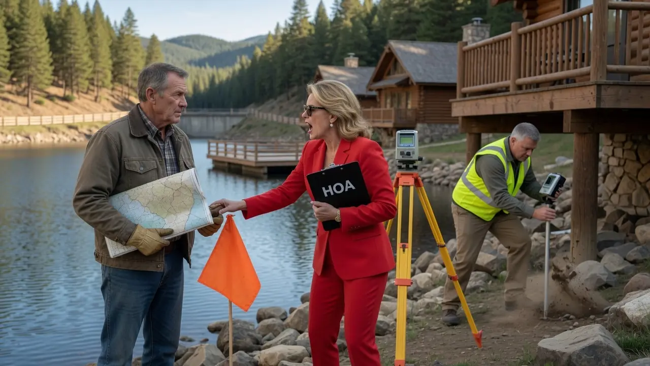
Linda Carver, president of the Silver Pines Homeowners Association, stood near the county engineers with both hands clenched around a folder.
“That marker cannot be correct,” she said.
The surveyor looked at her.
“It has been in the same recorded location for more than forty years.”
“The development plans show the community boundary extending to the water.”
“The development plans are not deeds.”
Linda turned toward Wade.
“You caused this.”
Wade looked across the exposed shoreline.
“No.”
His voice remained calm.
“I kept records.”
Behind them, another marker emerged as the water dropped.
Then another.
Orange flags placed during the earlier survey now aligned perfectly with the brass monuments buried along the shore.
Residents became quiet.
For months, Linda had told them Wade was confused, hostile, and trying to interfere with their community.
The lake was now placing physical evidence in front of their eyes.
Wade had not lowered it for revenge.
He had not opened the dam without permission.
He had simply allowed a scheduled maintenance operation to proceed while the county documented what decades of water had concealed.
The truth had always been there.
It only needed the water to move.
The Sullivan family had owned the ranch outside Elk Crossing, Colorado, for forty-six years.
Wade’s father, Robert Sullivan, purchased the original property in 1978.
Back then, the lake was little more than a wide creek basin fed by snowmelt from the northern ridge. Robert built a small earthen dam with county approval, then spent years improving the spillway, stabilizing the shoreline, and planting willows to control erosion.
The lake became known locally as Sullivan Lake.
It provided water for cattle, supported irrigation during dry summers, and served as a dependable reserve for wildfires.
Wade learned to swim there.
He caught his first trout near the western inlet.
His mother taught him to skate on the shallow cove during unusually cold winters.
Every part of the property carried a memory.
The cottonwood near the boathouse had been planted when Wade turned twelve.
The stone bench overlooking the dam marked his parents’ twenty-fifth wedding anniversary.
The old maintenance road beside the southern bank had been built by Wade and his father during the summer before Wade left for college.
Robert believed land could be loved without becoming sentimental about its operation.
He maintained detailed records.
Every dam inspection.
Every repair.
Every shoreline survey.
Every water-right filing.
Every change to the spillway.
“Memory gets weaker,” he once told Wade. “Paper gets stronger if you keep it properly.”
When Robert died, Wade inherited the ranch, the lake, and a filing cabinet heavy enough to require three men to move.
Wade kept every document.
That habit eventually saved the property.
For most of Wade’s life, the eastern side of the lake bordered open timberland owned by an elderly rancher named Howard Bell.
Howard used the land for seasonal grazing and hunting.
After he died, his children sold nearly three hundred acres to Crestline Development Group.
The company announced plans for an exclusive mountain cabin community.
Wade did not oppose the project.
The land was not his.
He attended one public planning meeting and asked only that the existing ranch boundary, private lake ownership, and dam-access corridor remain clearly marked.
A Crestline representative assured him they would.
The original county approval showed twenty-eight cabins set well back from the lake.
It also included a public walking trail entirely inside Crestline’s parcel and a shared viewing area overlooking the water from a distance.
The plan seemed manageable.
Then Crestline began revising it.
Twenty-eight cabins became forty-two.
The viewing area became a private clubhouse.
The walking path moved toward the shoreline.
A marketing brochure appeared online advertising:
PRIVATE LAKEFRONT LIVING
EXCLUSIVE COMMUNITY WATER ACCESS
MOUNTAIN CABINS WITH PERSONAL DOCK OPTIONS
Wade read the words twice.
No one had asked him about water access.
He called the developer.
A project manager named Darren Holt answered.
“The lakefront language is promotional,” Darren said.
“The lake is private.”
“We understand.”
“Then why are you selling dock options?”
“They’re conceptual amenities.”
“On whose water?”
Darren became less friendly.
“Our legal team has reviewed the project.”
“That wasn’t my question.”
The conversation ended without an answer.
Construction accelerated.
Trees fell along the eastern shore.
Excavators cut terraces into the hillside.
Concrete trucks arrived almost daily.
Wade watched the first cabins appear through the trees.
Several seemed dangerously close to the ranch boundary.
One retaining wall looked as though it crossed onto the protected shoreline.
He walked the boundary using his father’s old survey map.
The distances did not match what he saw.
That was when he hired a surveyor.
The first modern survey was completed in early spring.
Daniel Reyes, a licensed surveyor with thirty years of experience in mountain properties, spent two days locating old markers and comparing them with county records.
He found three original brass monuments beneath soil and vegetation.
The fourth was submerged near the normal waterline.
His preliminary conclusion was simple.
Crestline’s construction crews had used the lake’s current visible edge as though it were the property boundary.
It was not.
The legal boundary followed a surveyed line that remained fixed regardless of seasonal water level.
The ranch also owned a protected buffer extending around much of the shoreline.
At least three retaining walls crossed it.
Two cabin foundations appeared to extend partially onto Wade’s parcel.
Several docks had been installed in the ranch’s lake without permission.
Daniel recommended a full boundary survey.
Wade approved it.
Orange flags appeared along the shore.
The reaction from Silver Pines was immediate.
Linda Carver drove to the ranch the next morning.
She was fifty-eight, professionally dressed, and accustomed to having the first and final word in community discussions.
She had purchased one of the largest cabins and became HOA president before construction finished.
Linda parked near Wade’s barn and walked toward him holding a printed photograph of the survey flags.
“Your contractor has entered HOA property.”
“No.”
Wade continued repairing a gate hinge.
“My surveyor marked my boundary.”
“The lake is a community amenity.”
“It isn’t.”
“That’s not what owners were told.”
“Then someone lied to them.”
Linda’s mouth tightened.
“The development was approved by the county.”
“The approved plan does not transfer ownership of my lake.”
She opened a binder.
“The community maps clearly show our cabins extending to the shoreline.”
“Those are architectural plans.”
“They are official HOA documents.”
Wade straightened.
“An HOA document cannot transfer land.”
Linda looked toward the lake.
“You have always allowed people to enjoy the view.”
“Looking at water is not ownership.”
“You’re being unnecessarily hostile.”
“No. I’m being exact.”
He pointed toward her binder.
“My deed is recorded at the county office. So is the 1981 survey. So are the dam permits.”
Linda closed the binder.
“The HOA will review the matter.”
“Good.”
She stepped toward her SUV.
“Until then, your surveyors are not permitted inside the community.”
“They can remain on my land.”
“You believe it is your land.”
Wade watched her.
“That is what the deed says.”
The HOA held its first formal meeting about the lake two weeks later.
Wade attended with copies of the deed, surveys, dam records, and county plat maps.
The Silver Pines clubhouse overlooked the water through enormous glass windows.
A stone fireplace rose behind the board table. Decorative paddles and framed photographs made the building resemble an old mountain lodge, though it had been completed less than a year earlier.
Twenty cabin owners attended.
Many seemed confused rather than hostile.
They had been told the HOA controlled the shoreline.
Some had paid extra for “lake-access premiums.”
One owner had spent nearly $40,000 on a private dock package.
Linda opened the meeting by describing Wade’s survey as an attempt to disrupt the community.
Wade waited.
Then he placed the recorded deed on the table.
“The lake, dam, and surrounding ranch property have belonged to my family since 1978.”
Linda did not touch the document.
“The development plans were approved.”
“Approval to build on Crestline’s land does not create ownership of mine.”
A board member named Paul Greene examined the survey.
“These orange areas show encroachments?”
“Yes.”
“How many?”
“The final report is not complete.”
Linda interrupted.
“The survey was commissioned by Mr. Sullivan. It is not independent.”
“It was completed by a licensed surveyor using county records.”
“Paid by you.”
Wade looked toward the owners.
“Then hire another surveyor.”
Linda folded her hands.
“We don’t need to.”
That answer changed the room.
A woman near the front raised one hand.
“If there is a chance my cabin crosses his boundary, I want to know.”
Linda turned toward her.
“Melanie, the HOA’s counsel has assured us the development was properly approved.”
“Did the lawyer review his deed?”
Linda did not answer directly.
Wade distributed copies of the records.
He did not raise his voice.
He did not threaten to lock gates or drain the lake.
He asked the board to suspend shoreline construction until the boundaries were verified.
Linda refused.
Construction continued.
So did the sale of cabins.
That decision eventually cost the development millions.
Wade hired property attorney Claire Benson.
She reviewed every document at his kitchen table.
Her first question was about the dam.
“Who owns it?”
“I do.”
“Who operates it?”
“I do, under the county water-control plan.”
“Does the HOA have any agreement for lake access?”
“No.”
“Any easement?”
“No.”
“Any license?”
“No.”
“Did your family ever allow public use?”
“Neighbors occasionally fished with permission. That’s all.”
Claire studied the development maps.
“The developer’s engineers appear to have treated the normal high-water line as the ownership boundary.”
“Why would they do that?”
“Carelessness. Pressure to maximize cabin locations. Or because someone believed you would never challenge them.”
She turned to the recorded plat.
“The legal line is clear.”
“What happens to the owners?”
“That depends on the extent of the encroachments.”
“They bought in good faith.”
“Most probably did.”
“I don’t want families losing cabins because the developer lied.”
Claire looked at him.
“That may not be entirely within your control.”
“I want the responsible parties paying.”
“That part we can work toward.”
She sent formal preservation notices to Crestline, the HOA, the construction company, the title insurer, and the county.
She demanded that no additional work occur near the disputed boundary.
Crestline’s attorneys responded that the development relied on county-approved drawings and that any discrepancy was minor.
Then Daniel Reyes completed the final survey.
Five cabins crossed onto Wade’s property.
One by nearly thirty feet.
Seven retaining walls encroached on the shoreline buffer.
Twelve docks extended into the private lake.
Part of the clubhouse deck stood over the ranch boundary.
The dispute was no longer minor.
County officials opened a review.
Planning staff compared the approved development plan with the as-built construction.
The plans were inconsistent.
Several cabin locations had been shifted during construction without adequate boundary verification.
An engineering consultant working for Crestline had signed site certifications based on an incorrect reference line.
The county did not immediately order buildings demolished.
Instead, it issued a stop-work notice for all disputed shoreline activity and scheduled a formal review.
Linda continued assuring owners that Wade’s claims would fail.
She circulated a newsletter describing the ranch survey as “aggressive boundary reinterpretation.”
Claire responded with the original survey.
There had been no reinterpretation.
The line had existed for decades.
Residents began asking for HOA financial records and correspondence with Crestline.
Several documents were missing.
One email eventually surfaced showing that a junior engineer had warned Crestline about possible boundary conflicts before three of the cabins were built.
The message was forwarded to Darren Holt.
His response contained six words.
Use shoreline line. We’ll resolve later.
Later had arrived.
During the review, the county required another dam inspection.
Linda attempted to use the inspection against Wade.
She told cabin owners that the private dam might be unsafe and that Wade’s poor maintenance had created risk for the community.
The accusation spread quickly.
Claire advised Wade not to respond publicly until engineers completed their work.
A state-certified dam engineer named Monica Alvarez led the inspection.
She examined the embankment, spillway, outlet works, emergency channel, and maintenance records.
Wade provided four decades of documentation.
The structure passed.
Monica’s report found no immediate safety deficiencies.
It also confirmed that controlled seasonal drawdowns were part of the approved maintenance plan.
Every few years, the lake level could be reduced to inspect submerged portions of the structure, manage vegetation, remove debris, and verify shoreline markers.
The next scheduled drawdown had already been planned for September.
Linda objected.
She claimed lowering the water would damage community docks and reduce rental income.
Monica replied in writing.
The docks had never been authorized by the dam owner.
The maintenance schedule predated the development.
The work would proceed under county supervision.
Wade did not celebrate.
He knew the drawdown would make the conflict visible.
He also knew ordinary cabin owners would face consequences caused by decisions they had not made.
He sent a letter to every owner.
It explained the schedule, safety measures, and reason for the operation.
He invited them to observe from designated areas.
He also stated clearly that he would not touch or damage their property.
The county would document whatever the lowered water revealed.
Linda sent a competing letter.
She accused Wade of weaponizing the lake.
That phrase appeared repeatedly in local social media posts.
Wade did not respond.
The permits spoke for him.
On the morning of the drawdown, county inspectors arrived before sunrise.
The outlet was opened gradually.
Water moved downstream within permitted limits.
By midmorning, the lake had dropped several feet.
The first old boundary marker appeared.
Then a stone line recorded in Robert Sullivan’s original survey notes.
Then the remains of an old wire fence following the legal property boundary.
The physical evidence matched the deed exactly.
Cabin owners stood along the shore as surveyors placed numbered flags.
Cabin 14 crossed the line by eleven feet.
Cabin 17 by nearly twenty.
The foundation beneath Cabin 22 extended twenty-eight feet onto Sullivan land.
The decorative seawall in front of the clubhouse was almost entirely inside the ranch boundary.
One dock had been anchored directly into an old survey monument.
Linda watched the workers uncover it.
Her face went pale.
“You moved those markers,” she told Wade.
Daniel Reyes turned.
“Brass monuments set in concrete cannot be moved beneath six feet of water without leaving obvious disturbance.”
Linda looked toward the county official.
“This drawdown was unnecessary.”
Monica Alvarez shook her head.
“It was scheduled before the dispute reached court.”
“You’re all taking his side.”
“No,” Monica said. “We are measuring.”
That was the problem Linda could not overcome.
Measurements did not care who led the HOA.
GPS coordinates did not respond to confidence.
A lake could hide evidence.
It could not change ownership.
Crestline attempted to settle privately before the court hearing.
The company offered Wade money for the encroached land.
He refused the first proposal.
It required him to transfer the shoreline buffer, grant permanent lake access to the HOA, and accept ongoing community use of the dam road.
“They’re trying to buy the mistake cheaply,” Claire said.
“I won’t sell the dam access.”
“Good.”
“I might consider boundary licenses for some cabins.”
“That could protect innocent owners.”
“But Crestline pays.”
Claire nodded.
“And the documents must state that the lake remains private.”
Negotiations continued.
Linda opposed them.
She demanded full community ownership of the lakefront.
Several owners began questioning whether she represented their interests or her own authority.
One board member discovered Linda had received a discounted cabin upgrade from Crestline shortly before the HOA adopted its lake-access rules.
The discount had never been disclosed.
Another found that her husband’s property-management company had obtained the exclusive contract for Silver Pines vacation rentals.
Lakefront marketing increased the company’s revenue.
The conflict was not merely about community pride.
Linda had benefited from the illusion that Silver Pines owned the shoreline.
The board removed her as president before the final hearing.
The vote was six to one.
Linda cast the opposing vote.
The property case reached district court after months of surveys, inspections, and negotiation.
Judge Helen Brooks reviewed the chain of title, historic surveys, county approvals, and engineering evidence.
Crestline argued that the county’s acceptance of development plans created reasonable reliance.
The county responded that approval did not transfer property rights and that developers remained responsible for accurate boundaries.
The title insurer acknowledged coverage issues but disputed the amount of loss.
The HOA attempted to claim prescriptive access based on two years of community lake use.
Claire dismantled that argument quickly.
Two years was legally insufficient.
The use had also been disputed almost from the beginning.
Wade testified for less than an hour.
He explained how his father built the lake, maintained the dam, and preserved the records.
He described attending the HOA meeting and requesting that construction stop until the boundary was verified.
Crestline’s attorney asked whether Wade disliked the subdivision.
“No.”
“You opposed the cabins.”
“I opposed cabins being built on my land.”
“You refused to cooperate with the community.”
“I brought documents.”
“You could have resolved this privately.”
“I tried.”
The attorney pointed toward photographs from the drawdown.
“You intentionally lowered the lake during litigation.”
“The county followed the approved maintenance plan.”
“You knew the operation would embarrass the HOA.”
“I knew it would expose the shoreline.”
The attorney paused.
Wade continued.
“There is a difference.”
The judge’s written decision arrived three weeks later.
It confirmed the Sullivan ranch’s ownership of the lake, dam, and surveyed shoreline.
It declared the HOA’s lake-access rules invalid as applied to Wade’s property.
It found that Crestline had constructed improvements across the boundary after receiving enough information to investigate the conflict.
The court ordered the parties into a compliance process.
Not every cabin was demolished.
That would have punished buyers who had relied on developers and title professionals.
Instead, the resolution divided the encroachments into categories.
Two unoccupied cabins still owned by Crestline were removed.
Three occupied cabins received limited land-use licenses funded by Crestline and the title insurer. The licenses did not transfer ownership and would expire if the structures were replaced.
Unauthorized docks were removed unless owners negotiated individual seasonal permits with Wade.
The clubhouse deck and retaining wall were rebuilt entirely inside the HOA boundary.
The dam-access corridor remained exclusively under ranch control.
Crestline paid damages, legal costs, survey expenses, and restoration fees.
Its engineer faced a licensing review.
The county revised its inspection procedures for developments bordering private water bodies.
Linda’s husband lost the exclusive rental-management contract after owners learned how the cabins had been marketed.
Linda sold her cabin the following spring.
She never apologized to Wade.
He did not require one.
The boundary had been respected.
That was enough.
Most cabin owners remained.
Wade met with them individually.
Some were angry.
Others were ashamed.
Many had simply believed the sales materials.
A retired teacher named Joanne Mitchell owned Cabin 17, which crossed the boundary by nineteen feet.
“I would never have bought it if I knew,” she told Wade.
“I believe you.”
“I thought the lake was shared.”
“I know.”
“Do you hate us being here?”
Wade looked across the water.
“No.”
She appeared surprised.
“I hate being told my family’s property became community property because someone printed it in a brochure.”
Joanne nodded.
“That’s fair.”
Her land-use license required no major alteration of the encroaching section and prohibited commercial expansion. Crestline paid Wade for the limited use.
Joanne also signed a separate seasonal fishing agreement.
She became one of the most careful people around the lake.
When renters crossed ranch signs, she was often the first to correct them.
Silver Pines eventually adopted new rules.
No owner could advertise private lake access unless a valid agreement existed.
Guests could use only the authorized docks.
The dam road remained closed.
The shoreline buffer was marked clearly.
The HOA created a legal-review requirement for any future claim involving neighboring property.
The new president invited Wade to attend an annual boundary meeting.
He declined the formal position but agreed to have coffee with the board once a year.
That proved more useful.
The lake returned to its normal operating level after the maintenance work finished.
Water covered the brass markers again.
The old stone line disappeared beneath the surface.
But everyone now knew where it was.
Wade repaired the western dock with his son, Caleb, who had returned from college for the summer.
They replaced several boards and repainted the rail.
Caleb looked toward the cabins.
“Grandpa would have hated those.”
Wade smiled.
“He would have complained about the lights.”
“And the people?”
“Some of them.”
Caleb laughed.
Then he looked across the water.
“Did you ever think about selling?”
“During the lawsuit?”
“Before.”
Wade set down the drill.
“Your grandfather was offered money more than once.”
“Why did he refuse?”
“He believed the lake was part of the ranch.”
“It could still be part of the ranch under another owner.”
“That is true.”
Caleb waited.
Wade looked toward the dam.
“Ownership isn’t only possession. It is responsibility.”
“For the lake?”
“For everything that happens because the lake exists.”
The water supplied livestock.
It supported wildlife.
It provided emergency storage during fire season.
It also now sat beside forty luxury cabins occupied by people whose safety depended partly on Wade maintaining a structure they did not own.
“That sounds like a burden,” Caleb said.
“It is.”
“Then why keep it?”
Wade picked up the drill.
“Some burdens are promises.”
Wade created a shoreline stewardship plan the following year.
Cabin owners could volunteer for cleanup days but remained outside dam operations.
Fishing access was limited and documented.
Native vegetation was replanted where construction had damaged the buffer.
The HOA contributed to erosion repair without receiving ownership rights in return.
Children from Silver Pines helped plant willows under the supervision of ranch workers and county conservation staff.
One boy asked Wade why the orange flags remained near several cabins.
“They show the property line.”
“What happens if someone moves one?”
“The line stays where it is.”
The boy frowned.
“Then what’s the flag for?”
“To help people see what already exists.”
Wade smiled after saying it.
That was the entire story in one sentence.
The deeds had always existed.
The surveys had always existed.
The markers had always been beneath the water.
The HOA’s confidence did not create a new boundary.
The court did not invent Wade’s ownership.
It recognized what had already been true.
Years later, visitors still told different versions of the Silver Pines lake dispute.
Some claimed Wade drained the entire lake overnight and left the cabins sitting above dry mud.
That never happened.
Others said he opened the dam to destroy the HOA’s docks.
He did not.
The drawdown was scheduled, regulated, and supervised.
No property was intentionally damaged.
The real story was quieter.
A developer used the visible waterline instead of the legal boundary.
Warnings were ignored because correcting the plans would have reduced the number of cabins.
An HOA president treated marketing materials as though they were deeds.
And a rancher kept forty years of records because his father taught him that paperwork mattered as much as fences.
Wade did not win by shouting.
He won by measuring.
Survey monuments.
GPS coordinates.
Inspection records.
Permit numbers.
Recorded deeds.
The facts accumulated until confidence could no longer stand against them.
On the tenth anniversary of the court decision, Wade walked to the dam before sunrise.
Mist rested over the lake.
Cabin lights glowed faintly through the trees on the eastern shore.
The development remained.
So did the ranch.
The two had learned to exist beside each other without pretending their boundaries were optional.
Wade sat on the stone bench his father built.
He opened the old survey map and unfolded it across his knees.
Robert’s handwriting appeared in the margin.
Keep the outlet clear. Check marker 4 after every major drawdown. Never trust memory when you can measure.
Wade traced the words with one finger.
The lake looked endless in the morning fog.
It was not.
It had edges.
Everything did.
Land.
Authority.
Communities.
Patience.
Good neighbors understood those edges and respected them before they became disputes.
Bad leaders treated every boundary as an obstacle to be erased.
The lake had taught Silver Pines the difference.
When the sun rose above the ridge, light moved across the water toward the ranch.
Beneath the surface, the brass markers remained exactly where the surveyors had placed them decades earlier.
Invisible again.
But no longer ignored.